3D Photogrammetry & Site Surveys
We specialize in delivering precise, scalable, and interactive solutions using advanced 3D photogrammetry and site survey technologies.
What is 3D Photogrammetry?
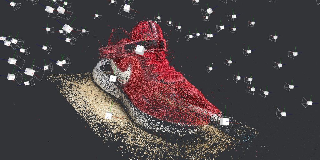
3D photogrammetry is the process of converting 2D images into accurate, textured 3D models. Using high-resolution photography and sophisticated algorithms, we create digital replicas of real-world environments for analysis, visualization, and measurement.
Key Features of 3D Photogrammetry:
• Data Capture from Drones, Cameras, or Scanners:
Collect high-resolution imagery using drones for large areas, cameras for detailed objects, or scanners for added precision.
• Photorealistic 3D Models:
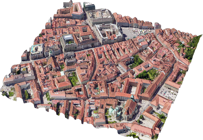
Generate detailed, textured 3D models that replicate real-world colors, textures, and surfaces with precision.
• Accurate Measurements and Analysis:
Extract critical data such as distances, contours, and volumes for use in construction, urban planning, mining, and more.
What is a 3D Site Survey?
3D site surveys combine photogrammetry with geospatial technologies like drones, LiDAR, and GNSS to generate accurate terrain maps and models. These surveys are faster, safer, and more efficient than traditional methods, offering a reliable foundation for planning and development.
Key Features of 3D Site Surveys:
• High-Precision Topographical Mapping:
Generate detailed terrain maps and elevation profiles with centimeter-level accuracy, ideal for construction, infrastructure planning, and environmental analysis.
• Seamless Integration with CAD, BIM, and GIS Platforms:
Export data directly to tools like AutoCAD, Revit, and ArcGIS for streamlined workflows, enabling precise design, modeling, and project management.
• Automated Analysis for Earthworks and Monitoring:
Analyze excavation volumes, monitor site progress, and detect changes over time, ensuring projects stay on schedule and within budget.
3D
Comprehensive
Services We Offer
1. High-Resolution 3D Photogrammetry
Transform any environment into a highly detailed, interactive 3D model with exceptional accuracy.
Deliverables:
3D Mesh Models: Ready-to-use models for analysis and presentation.
Digital Twins: Real-time virtual replicas of your environment.
Orthophotos & Digital Surface Models (DSM): High-resolution, georeferenced images and elevation data.
Point Clouds: Dense point clouds for advanced analysis and modeling.
Applications:
Architecture & Heritage Preservation: Create accurate digital replicas of historical structures.
Industrial Visualization: Visualize machinery, equipment, or facilities in 3D.
Real Estate Marketing: Offer immersive 3D tours of properties and developments.

2. Advanced 3D Site Surveys
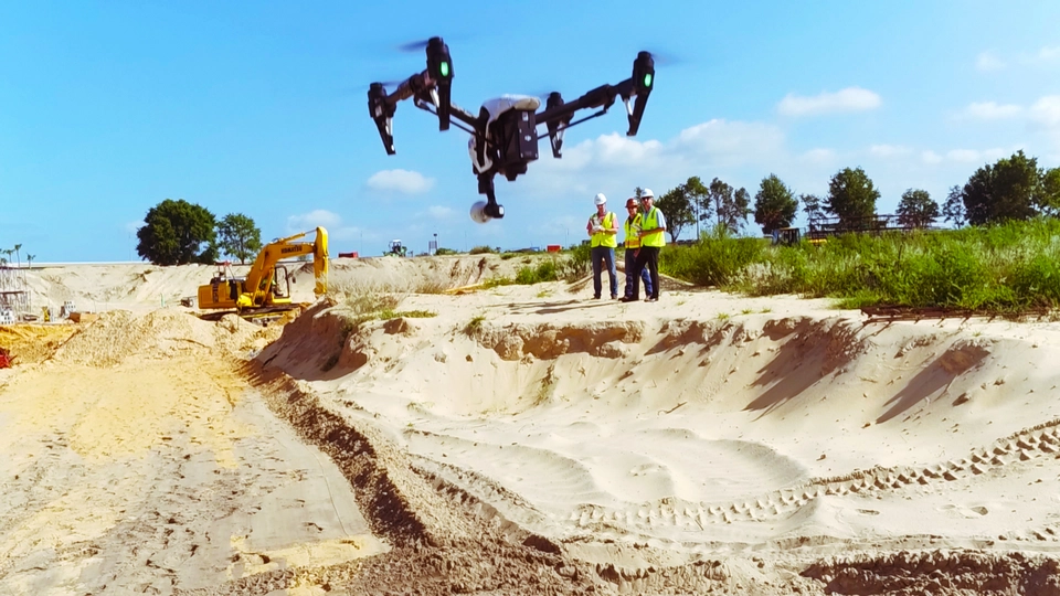
Leverage cutting-edge drone and LiDAR technology to accurately map and monitor your site, no matter the size or complexity.
Deliverables:
- Topographical Surveys: Capture elevation data and generate terrain profiles.
- Volume Calculations: Measure stockpiles, excavation sites, and fill volumes.
- Periodic Monitoring: Track progress over time to ensure compliance with project timelines.
Applications:
- Civil Engineering: Plan, monitor, and manage infrastructure projects.
- Mining & Aggregates: Accurately measure material volumes and optimize operations.
- Environmental Analysis: Conduct land-use studies and environmental impact assessments.

1. Data Collection:
Our team uses state-of-the-art equipment, including drones, LiDAR scanners, and high-resolution cameras, to capture data on-site.
2. Data Processing:
We use industry-leading software to process images and point clouds, generating precise 3D models and georeferenced outputs.
3. Analysis & Reporting:
Our experts analyze the data to extract actionable insights, such as terrain measurements, volumes, and dimensions.
4. Final Deliverables:
We deliver models, maps, and reports in your preferred format, ready for integration with CAD, BIM, or GIS workflows.
Unique Advantages of ZO3D
We follow a structured process to ensure that every AR project we deliver meets the highest standards of quality and performance.
Cutting-Edge Technology
Cutting-Edge Technology
- Drones & LiDAR: Capture vast areas quickly and efficiently.
- AI-Powered Processing: Accelerated data analysis for faster turnarounds.
- Cloud Integration: Access your models and data anytime, anywhere.
High Accuracy
- Achieve accuracy levels up to ±1 cm for critical measurements.
- Validate outputs with ground control points (GCPs) and georeferencing.
Custom Solutions
We customize every project based on your industry and specific requirements, ensuring seamless integration into your workflow.
Industries We Serve
1. Construction & Infrastructure Development
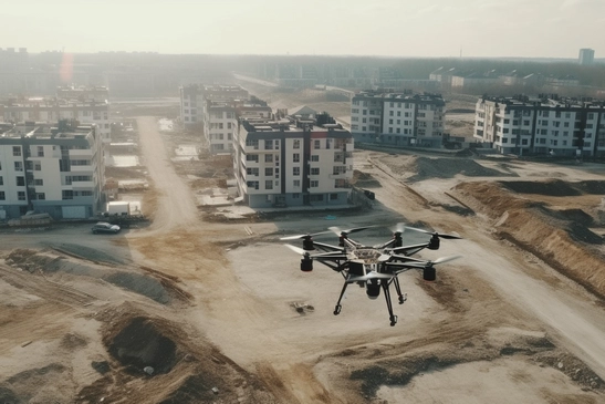
Plan, monitor, and execute projects with precise site surveys and 3D models.
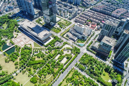
2. Real Estate & Urban Planning
Create immersive, interactive models for real estate marketing and urban design.

3. Mining & Aggregates
Accurately measure stockpile volumes and track site progress over time.
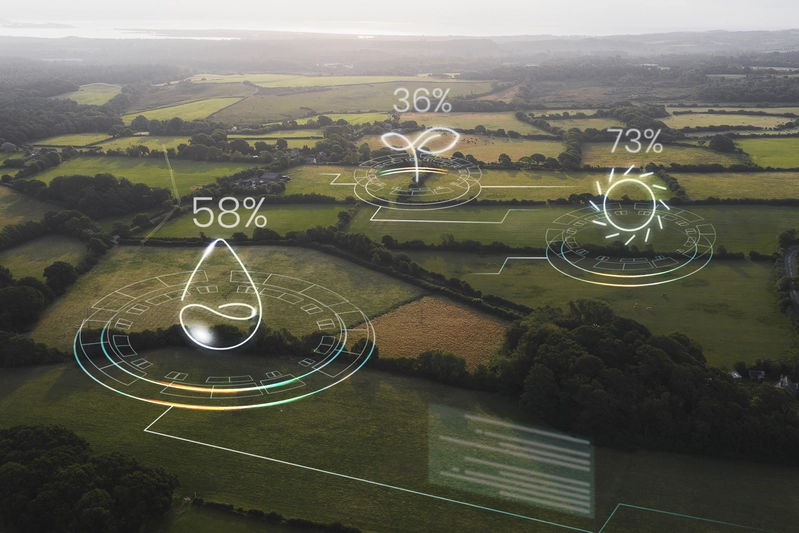
4. Environmental Management
Conduct terrain analysis and land-use studies for sustainable development.
Tools & Technologies We Use
- Drone Platforms: DJI Phantom, Matrice series, and custom UAVs.
- Photogrammetry Software: Pix4D, RealityCapture, and Agisoft Metashape.
- Geospatial Tools: LiDAR, GNSS systems, and RTK technology.
- Processing & Reporting Tools: AutoCAD, ArcGIS, QGIS, and BIM software.

Let’s Build Together
Transform your project today with ZO3D’s 3D Photogrammetry and Site Survey solutions. Whether you’re planning a construction site, preserving heritage, or managing large-scale operations, we have the tools and expertise to bring your vision to life.
your online shopping experience and drive more sales.
Frequently Asked Questions
1. How accurate are your surveys?
Our surveys deliver precision of up to ±1 cm, depending on factors such as the site conditions, project requirements, and equipment used. For added accuracy, we use ground control points (GCPs) and real-time kinematic (RTK) positioning. This ensures the data is precise enough for detailed applications like engineering designs, construction planning, and terrain modeling.
2. What equipment do you use for data collection?
We utilize a wide range of advanced tools, including:
- Drones (UAVs): Equipped with high-resolution cameras and LiDAR systems for capturing vast areas quickly.
- LiDAR Scanners: Ideal for generating detailed 3D models of complex terrains or structures.
- High-Resolution DSLR Cameras: Used for smaller objects or when extreme photorealism is required.
- GNSS Systems: Provide georeferencing for increased survey accuracy.
By combining these technologies, we tailor our approach to match the specific needs of each project.
3. Can I use the data in CAD or GIS platforms?
Yes, all deliverables are provided in industry-standard formats like DXF, OBJ, LAS, GeoTIFF, and more. This ensures seamless integration into platforms like:
- AutoCAD: For 2D drafting and 3D modeling.
- Revit: For BIM workflows in architecture and construction.
- ArcGIS & QGIS: For advanced geospatial analysis and mapping.
Our team ensures that the data is pre-processed for compatibility, so you can focus on your design and analysis work.
4. How quickly can I get results?
Our typical project turnaround is 2-5 business days, depending on the project size, complexity, and the volume of data. For smaller tasks like modeling individual objects or smaller sites, results can often be delivered in as little as 24 hours. Large-scale projects involving vast terrains or intricate details may require additional processing time. We prioritize efficiency while ensuring top-notch accuracy and quality.

